|
| |
Home >European
Touring > Europe 2006 > Slovenia Part 1
|
Slovenia - Part 1
Slovenia,
situated between Austria, Italy, Hungary and Croatia is about the size of
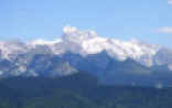
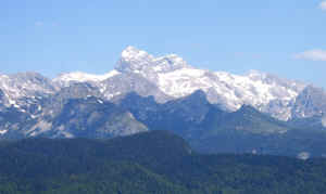
Wales with a population of just under two million. The terrain varies from the Julian Alps in the north west with
Mount Triglav the highest peak in the country at 2864 metres, unique Karst
rock formations with many caves and farming and
vineyards on the central and eastern plains and heavily wooded hills to
the south where brown bears still roam. It has a short coastline of 46km
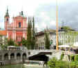
south of Trieste in Italy. The capital is Ljubljana a compact city in the
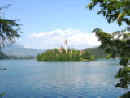
centre of the country. The most well known tourist centre is around Lake
Bled in the Triglav national park. It has been a member of the European
Union since 2004 and will adopt the Euro as its currency in 2007 to
replace the Tolar (SIT). The main
language is Slovenian but we found English was understood in most places
especially by the younger people. (Apologies for some inaccurate
spellings of accented Slovenian words)
Day 1 - into Slovenia and first
impressions
We entered Slovenia on the autostrada from Italy to Nova Gorica, a modern town of
blocks of flats with pitched roofs, hotels and casinos. After obtaining some
Tolars (350SIT =£1, 240SIT =€1) from a cash machine using our Nationwide debit card with
no problems we had a quick stroll around a mostly deserted shopping
precinct with much graffiti thinking this country must have more to offer
than this!
We also bought a detailed fold out road
map, essential as our satnav didn't cover Slovenia. The price of fuel is
fixed nationally and there are filling stations called PETROL in most
towns. Also
with the switch due in January 2007 Euros were accepted
everywhere. We set off on empty roads to our first campsite which
was a basic farm site about five miles east of the town at Lijak near
Sempas.
The owner's son spoke good English and invited us to sample their own
Merlot - of course we had to buy a bottle for 4€. The site is used by
paragliders (a few from Czech Republic were staying in tents) and is
gradually being upgraded with electric points and newer facilities. On a distant
hill was the name Tito cut into the forest. We didn't ask about it!
|
|
Day 2 - towards the mountains
After a peaceful night and a promising sunny morning which unfortunately wasn't
to last, we drove north west up the Soca Valley passing through
small mostly rural towns and gradually more rugged scenery, getting used to the
road signs and billboards with c, k, j and v in every word. The roads were mostly
reasonable but became narrower through a gorge after Kobarid, a favourite
adventure sports centre with kayaks and rafts on vans and trailers parked in
every layby, and we met the occasional coach and a few lorries. We eventually reached
Slap Boka, a high waterfall about 1 km up a rocky valley from the main road. The
guide books implied that it was a rough path but the final section to the base
of the waterfall became rather steep with loose stones so not wishing to suffer
twisted ankles so early in to our trip we took some photos and returned to the
carpark. Tourism is generally underdeveloped in this area and we were now in the Triglav
National Park so there were no gift shops or cafe just a portaloo, convenient for
those without their own on-board facilities.
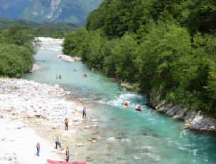
Water sports on the Soca River
We watched white water canoeists,
rafts and hydrospeeders coming down the river before heading to our next
campsite at Bovec in a wide flat valley, surrounded by the Julian Alps. A busy
town with adventure sports centres, two campsites and some winter sports
amenities nearby. There
were still damaged buildings from the earthquake a few years ago, also a useful
tourist information bureau, still open at 7.30 in the evening. There were a
couple of rather ugly modern hotels and holiday apartments in the centre of the
town.
|
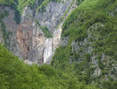
Slap Boka waterfall Soca valley
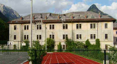
Earthquake damaged building at Bovec
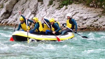
Rafting on the Soca river
|
Day 3 - from river valleys to Smlednik
We first drove further up the Soca Valley
towards the Predel Pass, a minor road crossing to Italy and stopped at Log
pod Mangartom a small village surrounded by steep mountains which had been
partially destroyed by a huge landslip in 2000. There is still plenty of
evidence of the torrent of rocks that had swept through the village and the
road bridge is still being rebuilt. We strolled through the village to read
the information boards explaining (in English) the tragic history of the
village especially during WW2. We returned to Bovec stopping at Fort Kluze
an impressive stronghold built by the Germans to defend this strategic
valley during WW1 (The courtyard is now used for concerts). Continuing back down the valley we turned off at
Kobarid passing over the restored Napoleon's bridge and on a minor road
through small hamlets to Tolmin and on to Most na Soci passing a large turquoise lake on the edge of the
town. After a stroll along the lakeside passing some strange modern
ironwork sculptures we then drove up a minor road quite narrow in places following
the valley and railway line to Podbrdo an industrial town where a car
transporter train runs north through a 6km tunnel to the Bohinj valley in
ten minutes avoiding a one hour tortuous drive over the mountains.
Motorhomes can be carried on the train but it only runs a few times a day and it's
best to book in advance. After a steep winding climb we descended through
another river valley to Zelezniki another industrial town and on busier
roads to Skofja Loka, a large town with modern housing estates but with an
attractive centre with many very old buildings. We found a free parking place by the
river and strolled around the old streets, a mix of smart shops and
buildings in need of repair.
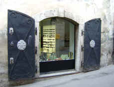
Shop window in Skofja Loka
We decided to head east to Smlednik where
there was a campsite listed but noticed roadside signs for a motorhome
stop which we discovered at Hotel Kanu on the minor road about 1km before the campsite,
so we stayed there for 10€ a night including electric hookup. There were
two other vans parked overnight and the pitches overlooked the hotel beach
volleyball courts, a popular sport in Slovenia so we were entertained in the
evening watching the sportsmen. There were also pleasant lanes around the
area for
strolling
through the fields with typical hayracks everywhere.
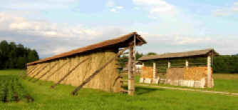
Typical Slovenian hayracks called "Kozolci"
The site was
situated about 12km north of Ljubljana which we visited the next day and
returned for a second night.
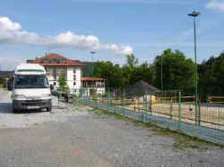
Stellplatz at Hotel Kanu, Smlednik
|
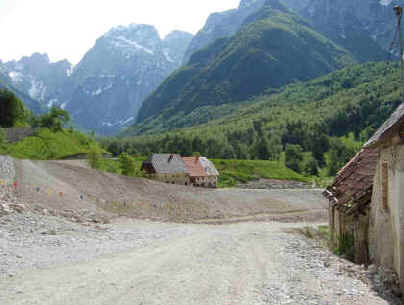
Remains of landslip at Log pod Mangartom
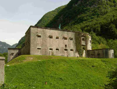
Fort Kluze from WW1
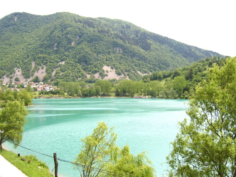
Turquoise lake at Most na Soci
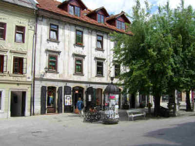
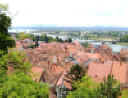
Skofja Loka centre
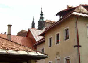
Skofja Loka rooflines
|
<< Back to Austria
|
. . .
on to Part 2 >>
|
| top | Home
| Europe 2006 | Campsites 2006
| European Touring |
|
